Welcome to The Great Outdoors
It is our intent to provide information, tips and hints that will be beneficial to the outdoor person

By
John William Uhler
~ Mitaku Oyasin ~
| Saint Anthony Sand Dunes Information | |
|---|---|
| Camping | Information |
| Designation | Location / Getting Here |
| Ecology | Rules and Regulations |
| Fees | Safety |
| Geology | Sand Mountain Wilderness Study Area |
| Habitat | Wildlife Protection |
|
Location The Saint Anthony Sand Dunes are located in Southeast Idaho in the United States. They are located northwest of the city of Rexburg, Idaho and west of the city of Saint Anthony, Idaho. The Sand Dunes is designated as a Special Recreational Management Area administed by the U.S. Department of the Interior Bureau of Land Management. The Saint Anthony Sand Dunes are 50 miles northeast of Idaho Falls, Idaho. ~ Getting Here ~ From U.S. Highway 20 Northbound - take the Rexburg / Salmon Exit 333 - turn left (west) onto Idaho State Road 33. Travel approximately 1.5 miles to 3000 West (turn right onto 3000 West) and follow the road to 4000 West (White Slough Road / Hibbard Highway [it turns into 1500 East]) the road comes to a T at 500 North. Turn right on 500 North, signs will lead you to the Egin Lakes Access on the left. This road takes you to the campground and day use area.
From U.S. Highway 20 Northbound - take the North Rexburg Exit 337. Turn left, onto 1900 East (Parker-Salem Highway and the Red Road). Travel 6.3 miles north to the 2nd flashing light (at the 4-way Saint Anthony Sand Dunes. Turn left and travel 0.85 miles to the split in the road. Stay right, over the railroad tracks and continue on 500 North for 2.9 miles. At the Egin Lakes Access sign turn right onto the paved access road. From U.S. Highway 20 Southbound - take Exit 346 (Saint Anthony City Center). Turn right onto Bridge Street and continue through the stop light to West 4th North. Turn left onto West 4th North, which turns into 600 North after you leave the city limits. Follow 600 North approximately 3 miles until you reach the intersection with Red Road. Turn left to go to Egin Lakes access or right to the parking and dispersed camping areas along Red Road. For more information, brochures, and maps, please follow this link to the Maps. 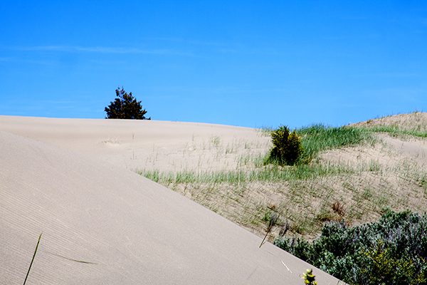
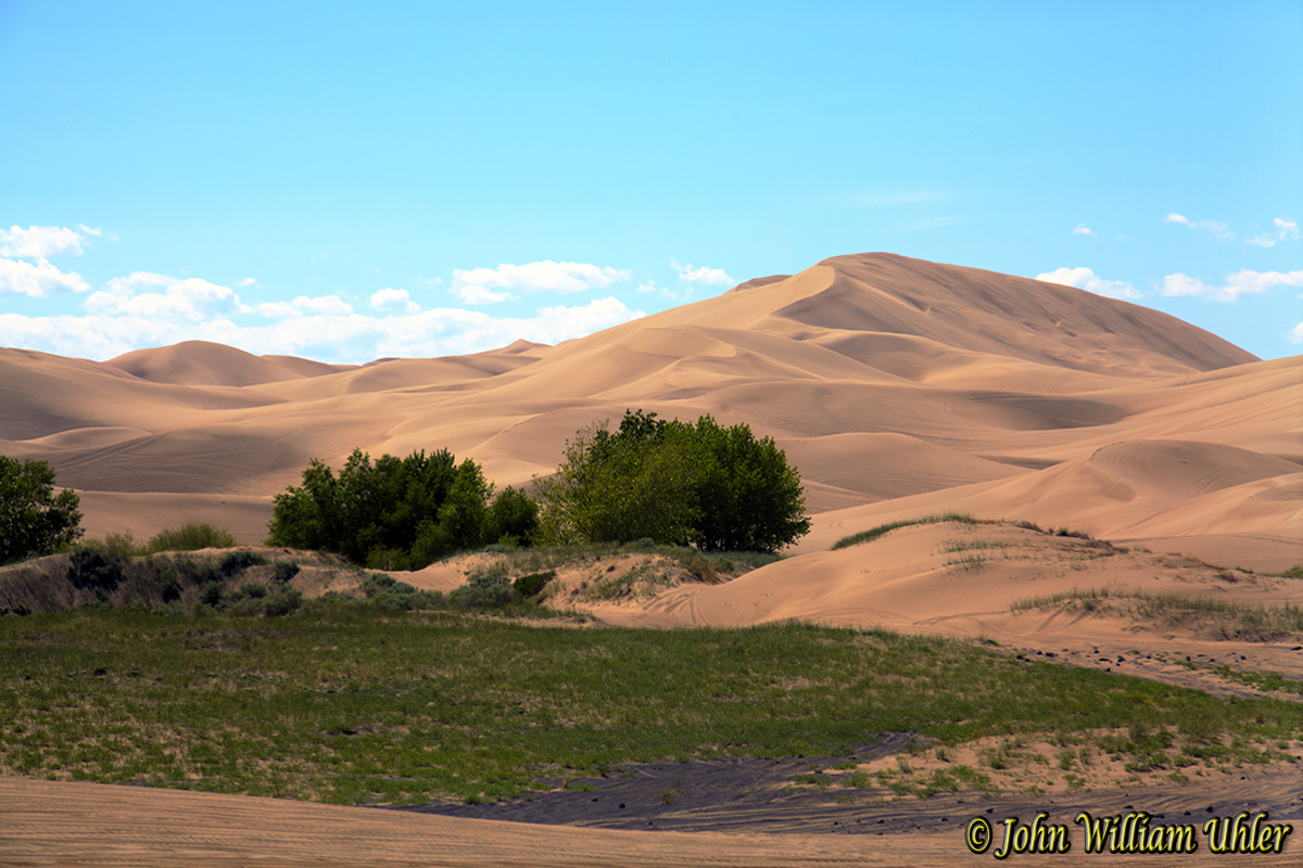
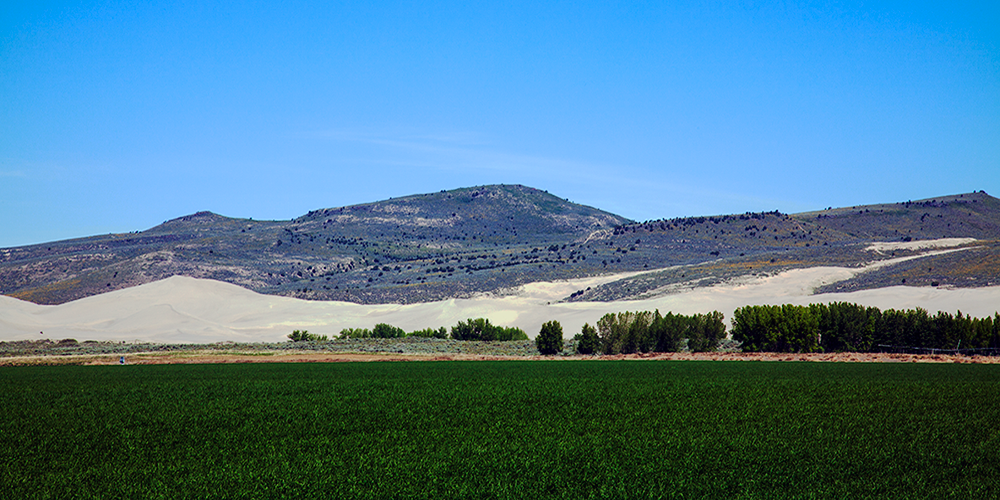
Designation and Information Designated 1987, 1985 - Medicine Lodge Resource Management Plan - 42,343 acres; 1,825 acres The Nine Mile Knoll Area of Critical Environmental Concern is located 6 miles west and northwest of the town of Saint Anthony and encompasses all of the Saint Anthony sand dunes found on public land, along with 36 square miles of vegetated desert to the south and southwest of the dunes. The Saint Anthony Sand Dunes Research National Area lies completely within the Area of Critical Environmental Concern boundary. The portion of the Area of Critical Environmental Concern covered with active dunes is also designated a Wilderness Study Area (WSA) and a Special Recreation Management Area. The dunes have also been evaluated for National Natural Landmark designation. The Saint Anthony Sand Dunes are the largest and most spectacular dunes in natural condition on the Columbia Plateau. Such large sand dunes so far inland are rare and geologically significant. Dunes range from 50 to 400 feet in height and cover a total of 175 square miles. The sand is blown in from the Snake River Lava Plain. Rounded hills to the north, the Juniper Buttes, are extinct volcanoes. The Area of Critical Environmental Concern protects habitat for unique wildlife: the largest and most viable population of a rare tiger beetle, known from only two other locations, and the Saint Anthony Dunes evening primrose, which grows only on these dunes Antelope, mule deer, moose and elk migrate long distances to winter in and around the dunes. The wintering elk population is the largest in North America. Seasonal human-entry closures ensure the integrity of the winter habitat The Research National Area designation acknowledges the area's unique ecology and complex vegetative cover. Activities in the Research National Area are limited to ensure that there are no changes in this vegetation. Endless Off Highway Vehicle opportunities, camping and horseback riding on 10,000 acres of dunes rising to 400 feet. Closure Information The riding area of the big dunes is open April 1 - December 31. The smaller dunes between Thunder Mountain and the Red Road are open year-round, but are usually are covered in snow by January 1. The big dunes and the surrounding area are part of a Winter Closure Area that starts January 1 - March 31 on the sand and through the month of April for the surrounding area outside the open sand dunes. 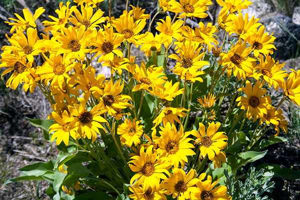
Ecology Skeletons of once-buried plants scattered around the dunes attest to the difficulty of life in active sand dunes. When you also consider the hot, dry summers, the cold, snowy winters and that only 13.4 inches of precipitation falls on the dunes each year, the challenges that the Saint Anthony Sand Dunes present to life become clear. In spite of the conditions, plants and animals do live in and around the dunes. The first plants to invade the open sands are grasses like sand wildrye (Elymus fiavescens) and scurfpea (Psoralea lanceolata). After about 30 years, those pioneer plants have stabilized the sand sufficiently for rubber rabbitbrush (Chrysothamnus nauseosus) and bitterbrush (Purshia tridentata) to begin their invasion. It can take as long as 700-900 years for the final, climax community of bitterbrush and chokecherry (Prunus virginiana var. demissa) to become fully established. Although you might expect the dunes to be inhospitable for animals, visitors will usually find the dunes crisscrossed with the tracks of small rodents, birds, and insects. In addition, many hooved animals migrate long distances to overwinter in and around the dunes, including antelope (Antilocapra americana), mule deer (Odocoileus hemionus), elk (Cervus elaphus) and moose (Aices aices). In fact, the Saint Anthony Sand Dunes hosts the largest desert wintering elk population in North America. These dunes are such a unique environment that several plants and animals live only at Saint Anthony Sand Dunes. The sand evening-primrose (Oenothera psammophila) is found nowhere else, and its relative the pale evening-primrose (Oenothera pallida) occurs in a special pubescent, or hairy, form (var. idahoensis), that is known to grow only in these dunes. In addition, the Saint Anthony Sand Dunes boasts the largest and most viable population of a rare tiger beetle (Cicindela arenicola) known from only two other locations, both in southern Idaho. 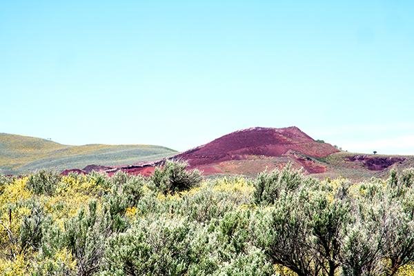
Geology Ten thousand years ago, when the weather in eastern Idaho was much cooler and wetter than it is today, lush vegetation was grazed by soon-to-be-extinct one-humped camels, mammoths, pony-sized horses, and large bison. These animals may have gone for a drink along the sandy shores of Mud and Market Lakes, about 20 miles southwest of where the Saint Anthony Sand Dunes lie today. Although Mud and Market Lakes still exist, they shrank considerably when the climate warmed at the end of the last ice age. As the shoreline sands dried out, that sand, as well as sand from floodplain deposits of the Snake, Teton, and other rivers, began to be blown into what we now know as the Saint Anthony Sand Dunes. Why did the wind-blown sand develop into dunes rather than being spread in an even layer across the landscape? The answer has to do with the very nature of sand. Geologists define sand as a particle small enough to be moved by the wind but too heavy to be carried very far. When a sand grain is lifted by the wind, it bounces along the surface. If the surface is hard, like the black, volcanic basalt rock exposed in some areas near the dunes, then bouncing sand grains just keep bouncing as they are pushed by the wind—like a basketball bounced on a gym floor. If, instead, the surface is soft because it is already sandy, then bouncing sand grains will lose momentum—like a basketball bounced on the beach. Because sand grains bouncing on sand slow down, if there happens to be a small pile of sand—perhaps accumulated in the wind shadow of a bush or a rock—then sand grains will tend to slow down and stop on that pile, and can eventually accumulate into a dune Although wind moves individual sand grains into dunes, it cannot move entire dunes. When sand grains are blown over the crest of a dune, they fall into the dune’s own wind shadow and accumulate on the other side of the crest. How, then, does the dune ever move forward? As more and more sand accumulates at the crest of a dune, it forms a steeper and steeper slope. When that very steep slope, or that slip face becomes unstable, gravity pulls the sand down in a small avalanche. You are familiar with slip faces and have created your own avalanches of sand if you have ever tried to climb up the downwind side of a dune! One slipping avalanche at a time, the dunes have marched steadily to the northeast, at about 10 feet per year, to reach their present location 20 miles from where they once began. The shape of a dune depends on the quantity of available sand and on wind conditions. Most dunes at Saint Anthony are barchan dunes, which form where sand is in limited supply and the winds blow steadily from the same direction. Barchan is Arabic for ram’s horn, and barchan dunes are so named because they form sharp crescents that end in a pair of horns that face in the direction of sand movement. At Saint Anthony, the horns of the dunes face northeast, so the winter winds from the southwest seem to move the sand. The Saint Anthony Sand Dunes are the largest tract of sand dunes in Idaho, covering approximately 175 square miles. The active dune field trends northeast for 35 miles and is five miles wide, with dunes ranging from 50 to 400 feet tall. Older dunes, now stabilized by plants, cover much of the surrounding area. The rounded hills on the north side of the dunes, the Juniper Buttes, are extinct volcanoes. Habitat and Wildlife Protection While the Saint Anthony Sand Dunes is a popular destination for recreationists, it is also an important habitat for wildlife and plants that call this area home. Please help us protect the wildlife habitat and the unique plant ecology found among the dunes by keeping an eye out for what's listed below. If you see a beetle or evening primrose plant, please do not ride over them. Ride or walk around. Riding only on the open sand and on designated routes will help you avoid damaging sensitive resources. BLM sensitive species like the Bald eagle, Swainson's Hawk and the Ferruginous Hawk hunt, nest and breed in this area. 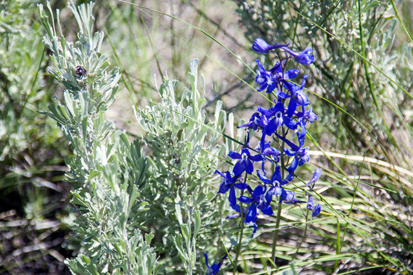
Camping / Fees - Egin Lakes Campground The Egin Lakes Campground offers a potable water system, RV dump station and 48 improved camp units, including electrical service for 28 camp sites.
Please Note: Sharing electrical service between units is prohibited. Only one camping unit at a time is permitted to operate off a each electrical pedestal. Please carefully read the instructions located on each panel for hook-up and safety. Other Fees
Other Information
More Local Accomodation Options for Dune Access
Open Campfire Rules
Facilities
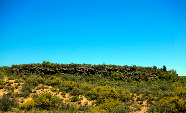
Sand Mountain Wilderness Study Area Egin Lakes access is located midway along a 15 mile stretch of sand dunes. To the east are small rolling hills suitable for beginning ATVers or youngsters. To the west are challenging hills - mountains of sand up to 425 feet high. Surrounding the dunes is another 10,000 acres of juniper and sagebrush. Together the two land types comprise the Sand Mountain Wilderness Study Area (WSA). WSAs - What Are They WSAs are tracts of land that meet criteria set forth by Congress for potential inclusion in the Wilderness Preservation System. These lands are managed to protect natural values until such time as Congress decides to designate them Wilderness or release them for further study How does WSA status affect Off-road Vehicle recreation The BLM is required by law to maintain the natural values of the area. This is the focus of management and the basis for rules and regulations. However, there is room for a variety of responsible activities to occur. Thousands of off-road vehicle users, horseback riders, and others enjoy the freedom of the sand dunes each year Rules and Regulations Stay on the open sand! As managers and stewards of a WSA, the BLM must maintain the natural landscape surrounding the dunes. Further, this area provides critical range for 1,500 deer and 2,500 elk, and habitat for sharptail and sage grouse. Recreation use leading to destruction of vegetation or other natural features could force closure of this area. Thus, there is one overriding regulation: STAY ON THE OPEN SANDS! Unless a route is specifically signed open with a “Designated Route” sign, it is closed. Remember, the natural resources of an area provide the basis for the quality of your experience. Do your part to protect them and keep them clean. Your cooperation is appreciated. Within the WSA, no camping or fires are allowed except in the designated area along Red Road Is camping allowed No camping is allowed inside the WSA except in designated areas adjacent to the Eastern boundary of the WSA along Fremont County Red Road. 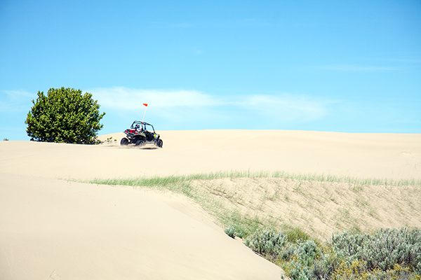
Safety Rules and Regulations BEFORE riding
WHILE riding
Where can I ride?
What other safety information should I know?
What equipment is recommended?
Please watch video: Fun in the Sand Information provided by the Bureau of Land Management. BLM - Upper Snake River Field Office Check out the Calf Creek Page for information on camping and hiking in Southern Utah. |
| Great Outdoor Recreational Places |


